NEW PAPER: Paleolake geochronology supports Last Glacial Maximum (LGM) age for human tracks at White Sands, New Mexico
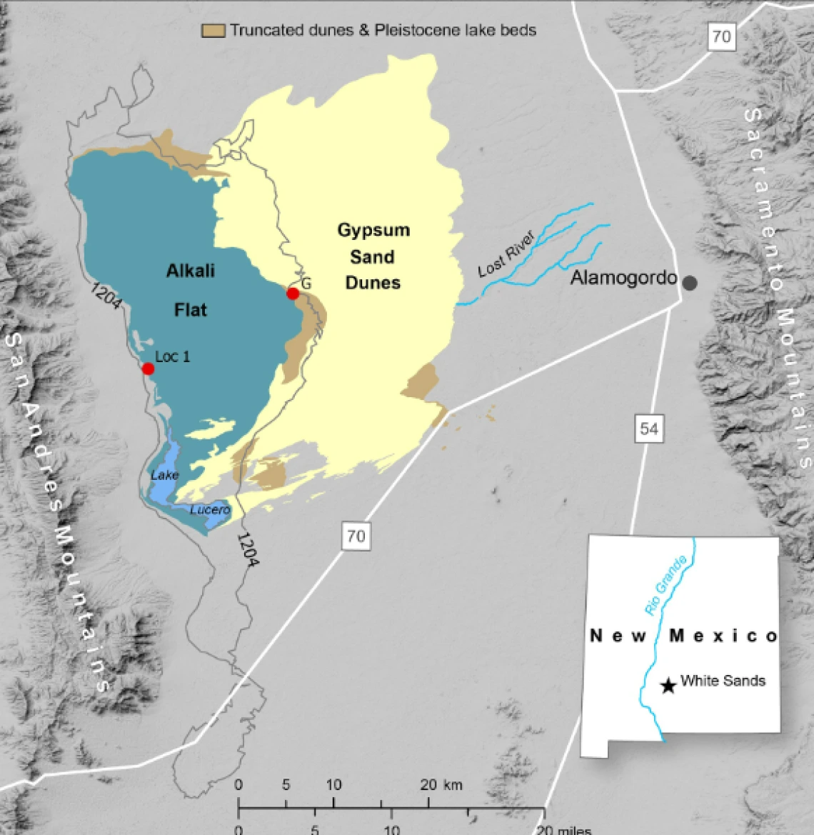
Fig. 1. Field area setting.
The northern Tularosa Basin showing the area of the White Sands (“Gypsum Sand Dunes”), the Alkali Fat deflation basin, modern Lake Lucero, and present-day Lost River, which drains southwest across the distal piedmont until it is buried by the gypsum dunes (see also fig. S4). The 1204-m contour line approximates the proposed extent of paleolake Otero (15). It was likely more extensive given the >4 m of lake beds at “G.” The two field areas (red dots) are as follows: “G” is the area of Gypsum Overlook, the Central study area, and WHSA Locality 2; “Loc 1” is a stratigraphic section along the west margin of Alkali Flat. The brown pattern at G is the area of exposures of deposits linked to paleolake Otero and overlain by truncated Holocene dunes (31). The inset shows the location of the White Sands and the Tularosa Basin within New Mexico [based on figure 1 in (31)]. Image credit: X. Gong and A. Cowart, University of Wisconsin Cartography Lab.